Route

Eliot Glacier - Sunshine Route, North American Cordillera

Mountain: Mount Hood (3 429 m / 11 250 ft)
Activity type: Backcountry Skiing
Activity level: Moderate
Elevation: 3 429 m / 11 250 ft
Duration: 10 Hour(s)
Expenses: from$ 700
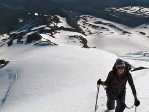
Image of Eliot Glacier - Sunshine Route, North American Cordillera
Credit: www.jeffreyjhebert.com

Overview

Route Name:
Eliot Glacier - Sunshine Route, Ледник Элиота - Солнечный маршрут
Activity type:
Backcountry Skiing
Activity level:
Moderate
Type of Climb:
Snow & Ice
Location:
North America, United States (USA): (Oregon)
Starting Point:
Parent Range:
Mountain:
First Ascent:
??/??/1892 Bill Langille
Duration:
10 Hour(s)
Max. Elevation:
3 429m / 11 250 ft
Vertical Gain: Please update
Length: Please update
Climbing Season(s):
01 Apr-31 Jul;
Nearst
Airport(s):
Convenience Center(s):
National
Park(s):

Location

North America, United States (USA): (Oregon)
  • Your Chance To Edit •  Add / Share you knowledge with mates

    This route ascends the Elliot Glacier to the summit ridge. It is a fine, nontechnical glacier outing that is very popular.
  • Description Edit •  Add / Share you knowledge with mates

    The approach to the Eliot Glacier follows the lower aspects of the Cooper Spur route. With the impressive headwall above, descend down from the lateral moraine along a climbers trail below the spur to the Eliot Glacier and cross toward the right side of the glacier roughly aiming for Horseshoe Rock. The climb avoids the upper Eliot Glacier Icefall to the climber's left and the lower icefall to the right. Climb towards the snowdome and on toward Cathedral Ridge. Navigate across the bergshrund and at this point continue up the ridge to the summit.
  • Getting There Edit •  Add / Share you knowledge with mates

    From Portland take Interstate 84 to Hood River and drive south on State Highway 35 towards Mount Hood for approximately 20 minutes. Turn right on Cooper Spur Road the second time you encounter it. It is a loop. Two and a half miles later turn left on Cloud Clap Road. This is located right across from the Cooper Spur Inn. Take the right fork of this road and go nine miles. Turn right at the "T" towards the Cloud Cap Campground. The drive from Portland takes 2 hours. At Cloud Cap Campground follow the Timberline Trail 600.
  • Red Tape Edit •  Add / Share you knowledge with mates

    A Northwest Forest Pass ($5/day or $30/year) is required to park at the trailhead.
  • Are You Ready? Edit •  Add / Share you knowledge with mates

  • Tips Edit •  Add / Share you knowledge with mates

    Cellular Network: No (Guided Tours)


  • Parameters Edit •  Add / Share you knowledge with mates

    Base Camp Elevation: 2 560 m / 8 400 ft
    Summit Camp Elevation: Please update
    Accommodation in Base Camp: Please update
    Accommodation above Base Camp: Please update
    Number of Camps: Please update
    Avg. Cost: 700 USD
    Age Restrictions: Please update
    Soloing: Please update
    Descent Route: Same
    Specify descent time: Please update
  • Key Points Edit •  Add / Share you knowledge with mates

    Name (Elevation) Description
  • Agencies Edit •  Add / Share you knowledge with mates

    Guided Tours
    Accomodation
  • GPS-Tracks

    Add
  • Did You Know Edit •  Add / Share you knowledge with mates

  • References Edit •  Add / Share you knowledge with mates

Last update: Slava Shevtsov (02 Jul 2018) • History
No one has been added yet

0 climber who were here

Sort by:

show:

  • 6
  • 18
  • 36

Join the growing Alpine Community now.