

KILIMANJARO CLIMB - 7 DAYS MACHAME ROUTE
| Activity type: | Trekking |
| Activity level: | Moderate/ Challenging |
| Availability: |
12 Feb 2019 - 31 Dec 2020 |
| Duration: | 7 Day(s) / Tour with flexible start dates |
| Price: | from $1499 / Negotiable |
Full description
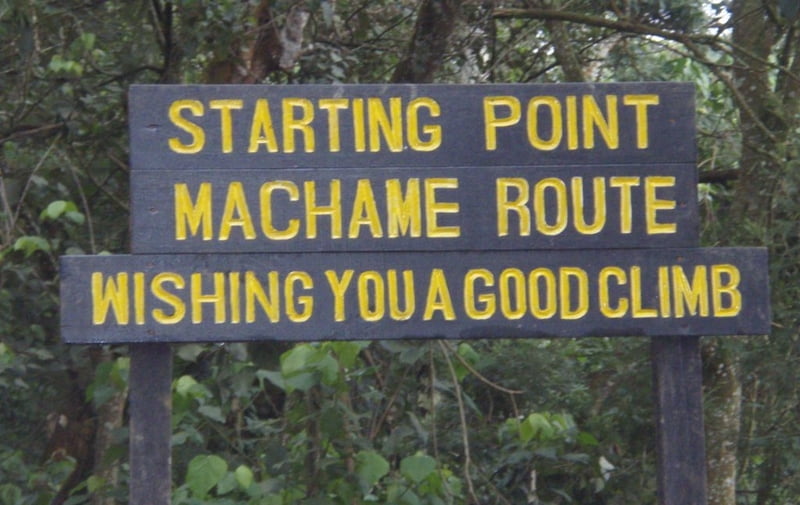
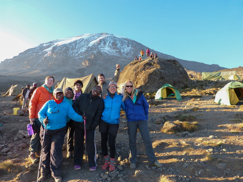
The Machame route, also known as the “Whiskey” route, is the most popular route on Kilimanjaro. Machame’s draw is in its scenic beauty. However, the trail is considered difficult, steep and challenging, particularly due to its shorter itinerary. Therefore this route is better suited for more adventurous folks or those with some high altitude, hiking or backpacking experience.
The route approaches Mount Kilimanjaro from the south, beginning with a short drive from Moshi to Machame Gate. The path leads hikers through the rain forest to Shira Plateau. Here, many of Kilimanjaro’s routes converge. Then the route turns east and traverses underneath Kilimanjaro’s Southern Ice Field on a path known as the Southern Circuit before summiting from Barafu. Descent is made via the Mweka route.
Shika Tours and Safaris offers Machame as a seven-day group climb or as a six-day private climb. The six-day variation combines days four and five, going from Barranco Camp to Barafu Camp without staying at Karanga.
ITINERARY
DAY 1
Machame Gate to Machame Camp
Elevation: 5,380 ft to 9,350 ft
Distance: 11 km/7 miles
Hiking Time: 5-7 hours
Habitat: Rain Forest
The drive from Moshi to the Machame Gate takes about 50 minutes. The journey passes through the village of Machame which is located on the lower slopes of the mountain. As we leave the park gate, we walk through the dense rain forest on a winding trail up a ridge until we reach the Machame Camp.
DAY 2
Machame Camp to Shira 2 Camp
Elevation: 9,350 ft to 12,500 ft
Distance: 5 km/3 miles
Hiking Time: 4-6 hours
Habitat: Heath
We leave the glades of the rain forest and continue on an ascending path up to a steep, rocky ridge. On the Shira Plateau, we pass through heather and open moorlands, then cross a large river gorge to Shira 2 Camp.
DAY 3
Shira 2 Camp to Lava Tower
Elevation: 12,500 ft to 15,190 ft
Distance: 7 km/4 miles
Hiking Time: 4-5 hours
Habitat: Alpine Desert
Lava Tower to Barranco Camp
Elevation: 15,190 ft to 13,044 ft
Distance: 3 km/2 miles
Hiking Time: 2-3 hours
Habitat: Alpine Desert
We continue to the east up a ridge and then head southeast towards the Lava Tower – a 300 ft tall volcanic rock formation. We descend down to Barranco Camp through the strange but beautiful Senecio Forest to an altitude of 13,000 ft. Although you begin and end the day at the same elevation, the time spent at higher altitude is very beneficial for acclimatization.
DAY 4
Barranco Camp to Karanga Camp
Elevation: 13,044 ft to 13,106 ft
Distance: 5 km/3 miles
Hiking Time: 4-5 hours
Habitat: Alpine Desert
We begin the day by descending into a ravine to the base of the Great Barranco Wall. Then we climb the non-technical but steep, nearly 900 ft cliff. From the top of the Barranco Wall, we cross a series of hills and valleys until we descend sharply into Karanga Valley. One more steep climb up leads us to Karanga Camp. This is a shorter day meant for acclimatization.
DAY 5
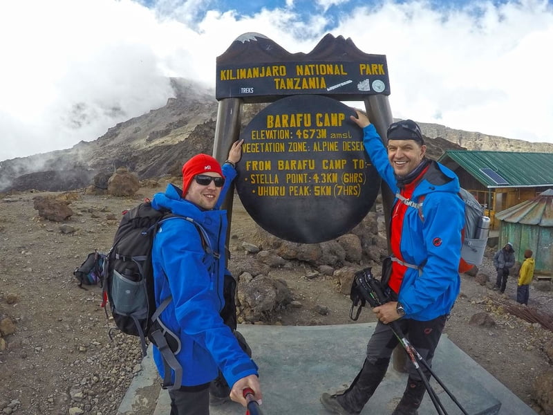
Karanga Camp to Barafu Camp
Elevation: 13,106 ft to 15,331 ft
Distance: 4 km/2 miles
Hiking Time: 4-5 hours
Habitat: Alpine Desert
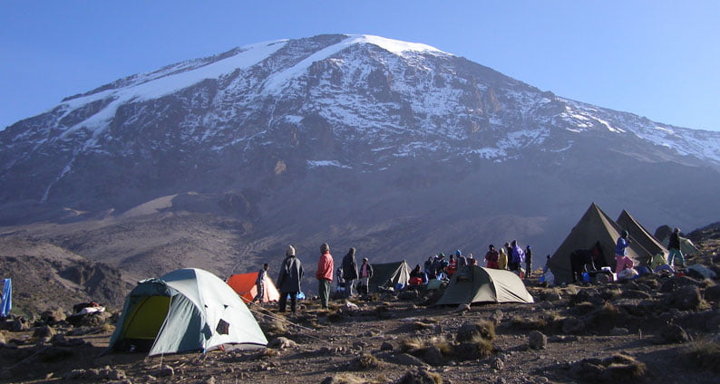
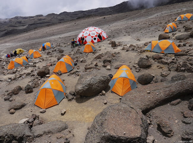
We leave Karanga and hit the junction which connects with the Mweka Trail. We continue up to the rocky section to Barafu Hut. At this point, you have completed the Southern Circuit, which offers views of the summit from many different angles. Here we make camp, rest and enjoy an early dinner to prepare for the summit day. The two peaks of Mawenzi and Kibo are viewable from this position.
DAY 6
Barafu Camp to Uhuru Peak
Elevation: 15,331 ft to 19,341 ft
Distance: 5 km/3 miles
Hiking Time: 7-8 hours
Habitat: Arctic
Uhuru Peak to Mweka Camp
Elevation: 19,341 ft to 10,065 ft
Distance: 12 km/7 miles
Hiking Time: 4-6 hours
Habitat: Rain Forest
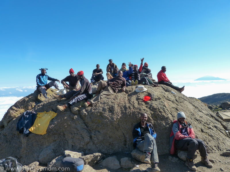
Very early in the morning (around midnight), we begin our push to the summit. This is the most mentally and physically challenging portion of the trek. The wind and cold at this elevation and time of day can be extreme. We ascend in the darkness for several hours while taking frequent, but short, breaks. Near Stella Point (18,900 ft), you will be rewarded with the most magnificent sunrise you are ever likely to see coming over Mawenzi Peak. Finally, we arrive at Uhuru Peak- the highest point on Mount Kilimanjaro and the continent of Africa.
From the summit, we now make our descent continuing straight down to the Mweka Hut camp site, stopping at Barafu for lunch. The trail is very rocky and can be quite hard on the knees; trekking poles are helpful. Mweka Camp is situated in the upper forest and mist or rain can be expected in the late afternoon. Later in the evening, we enjoy our last dinner on the mountain and a well-earned sleep.
DAY 7
Mweka Camp to Mweka Gate
Elevation: 10,065 ft to 5,380 ft
Distance: 10 km/6 miles
Hiking Time: 3-4 hours
Habitat: Rain Forest
On our last day, we continue the descent to Mweka Gate and collect the summit certificates. At lower elevations, it can be wet and muddy. From the gate, we continue another hour to Mweka Village. A vehicle will meet us at Mweka Village to drive us back to the hotel in Moshi.
Price includes
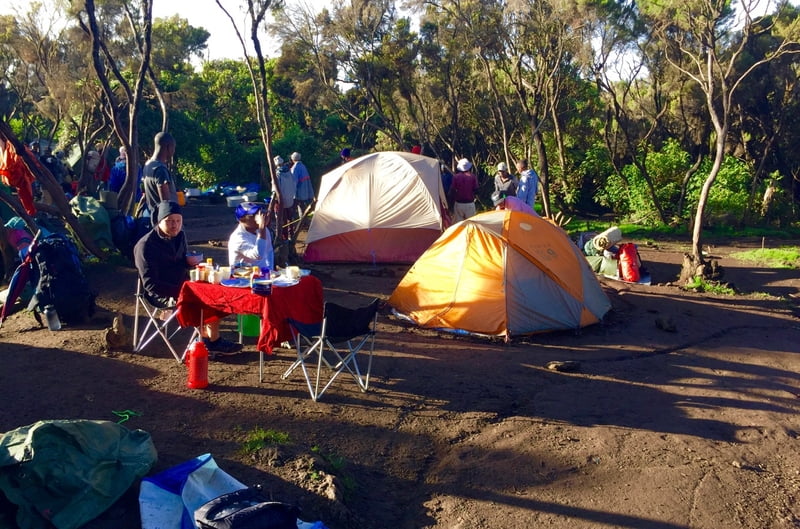
- - Private transport from Kilimanjaro International Airport to your accommodations in Moshi. - 2 nights of accommodation at Parkview Inn. - Private transport to and from the hotel to the Kilimanjaro Park Gate - National Park entry fees and hut fees - Kilimanjaro Park rescue team fees - Government taxes - 3 freshly-prepared delicious meals daily on the mountain prepared by professional cooks whom are happy to accommodate your dietary needs - 3-4 liters of mineral/treated water per person per day - Hot drinks on the mountain and hot water for washing - Friendly and highly qualified mountain guides, assistant guides and professional cooks - Enough Porters to carry camping gear and additional baggage - Accommodation in Huts/camping - Portable oxygen tanks, ox meter and emergency first-aid kit - Porter’s Cook’s and Guide’s Salary.
Not included in price
- - Lunches, dinners and drinks at your hotel in Moshi before climb and before safari. - Personal items and toiletries - Tips for guides, porters and cook (this is a guide to tipping on the mountain. Tipping on Kilimanjaro from the trekking group (not per climber): • Guides: US$10/day/guide • Cook: US$8/day • Porter: US$5/day/porter
Guide

Verified Profile
- Email address
- Phone number
I began climbing Mount Kilimanjaro in 2011 as a porter and after about two years, I became one of the most beloved and skilled guides in the business. I have an amazing sense and knowledge of the mountain and has led hundreds of clients to its peak. I have also been guiding safaris for three years, using my vast knowledge of Tanzanian nature and wildlife. I studied at the Professional Tour Guide School in Mombasa Kenya, completing My course in 2010. I worked with Popote Africa Adventure and another well-known company before founding SHIKA TOURS AND SAFARIS. I’m energetic, extremely funny, and most importantly, experienced. I will give you a trip your Lifetime
Location
Tanzania, Kilimanjaro Region, Rombo
Day 1
Machame Gate to Machame Camp
Machame Gate to Machame Camp
Elevation: 5,380 ft to 9,350 ft
Distance: 11 km/7 miles
Hiking Time: 5-7 hours
Habitat: Rain Forest
The drive from Moshi to the Machame Gate takes about 50 minutes. The journey passes through the village of Machame which is located on the lower slopes of the mountain. As we leave the park gate, we walk through the dense rain forest on a winding trail up a ridge until we reach the Machame Camp
Day 2
Machame Camp to Shira 2 Camp
Elevation: 9,350 ft to 12,500 ft
Distance: 5 km/3 miles
Hiking Time: 4-6 hours
Habitat: Heath
We leave the glades of the rain forest and continue on an ascending path up to a steep, rocky ridge. On the Shira Plateau, we pass through heather and open moorlands, then cross a large river gorge to Shira 2 Camp.
Day 3
Shira 2 Camp to Lava Tower
Elevation: 12,500 ft to 15,190 ft
Distance: 7 km/4 miles
Hiking Time: 4-5 hours
Habitat: Alpine Desert
Lava Tower to Barranco Camp
Elevation: 15,190 ft to 13,044 ft
Distance: 3 km/2 miles
Hiking Time: 2-3 hours
Habitat: Alpine Desert
We continue to the east up a ridge and then head southeast towards the Lava Tower – a 300 ft tall volcanic rock formation. We descend down to Barranco Camp through the strange but beautiful Senecio Forest to an altitude of 13,000 ft. Although you begin and end the day at the same elevation, the time spent at higher altitude is very beneficial for acclimatization.
Day 4
Barranco Camp to Karanga Camp
Elevation: 13,044 ft to 13,106 ft
Distance: 5 km/3 miles
Hiking Time: 4-5 hours
Habitat: Alpine Desert
We begin the day by descending into a ravine to the base of the Great Barranco Wall. Then we climb the non-technical but steep, nearly 900 ft cliff. From the top of the Barranco Wall, we cross a series of hills and valleys until we descend sharply into Karanga Valley. One more steep climb up leads us to Karanga Camp. This is a shorter day meant for acclimatization.
Day 5
Karanga Camp to Barafu Camp
Elevation: 13,106 ft to 15,331 ft
Distance: 4 km/2 miles
Hiking Time: 4-5 hours
Habitat: Alpine Desert
We leave Karanga and hit the junction which connects with the Mweka Trail. We continue up to the rocky section to Barafu Hut. At this point, you have completed the Southern Circuit, which offers views of the summit from many different angles. Here we make camp, rest and enjoy an early dinner to prepare for the summit day. The two peaks of Mawenzi and Kibo are viewable from this position.
Day 6
Barafu Camp to Uhuru Peak
Elevation: 15,331 ft to 19,341 ft
Distance: 5 km/3 miles
Hiking Time: 7-8 hours
Habitat: Arctic
Uhuru Peak to Mweka Camp
Elevation: 19,341 ft to 10,065 ft
Distance: 12 km/7 miles
Hiking Time: 4-6 hours
Habitat: Rain Forest
Very early in the morning (around midnight), we begin our push to the summit. This is the most mentally and physically challenging portion of the trek. The wind and cold at this elevation and time of day can be extreme. We ascend in the darkness for several hours while taking frequent, but short, breaks. Near Stella Point (18,900 ft), you will be rewarded with the most magnificent sunrise you are ever likely to see coming over Mawenzi Peak. Finally, we arrive at Uhuru Peak- the highest point on Mount Kilimanjaro and the continent of Africa.
From the summit, we now make our descent continuing straight down to the Mweka Hut camp site, stopping at Barafu for lunch. The trail is very rocky and can be quite hard on the knees; trekking poles are helpful. Mweka Camp is situated in the upper forest and mist or rain can be expected in the late afternoon. Later in the evening, we enjoy our last dinner on the mountain and a well-earned sleep.
Day 7
Mweka Camp to Mweka Gate
Mweka Camp to Mweka Gate
Elevation: 10,065 ft to 5,380 ft
Distance: 10 km/6 miles
Hiking Time: 3-4 hours
Habitat: Rain Forest
On our last day, we continue the descent to Mweka Gate and collect the summit certificates. At lower elevations, it can be wet and muddy. From the gate, we continue another hour to Mweka Village. A vehicle will meet us at Mweka Village to drive us back to the hotel in Moshi.
Users
average
Last update: Levis Manase
(1 Jan 2021)