

0 elements (0 brands)
Created: Mount Adventure Ho...
Last update: 17 Mar 2018
| Activity type: | Hiking |
| Activity level: | Moderate/ Challenging |
| Availability: |
6 Jun 2018 - 20 Jun 2018 |
| Duration: | 14 Day(s) / Tour with flexible start dates |
| Price: | from $1200 / Negotiable |
HIGHLIGHTS
Enjoy a trail far less crowded than its more well known peers
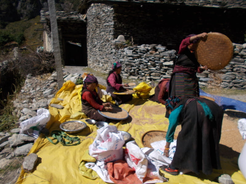
The trek is full of wild, remote and unique culture.
The trailhead is reached over land, avoiding the need for domestic flights
The scenery displays all Nepal has to offer
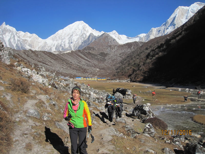
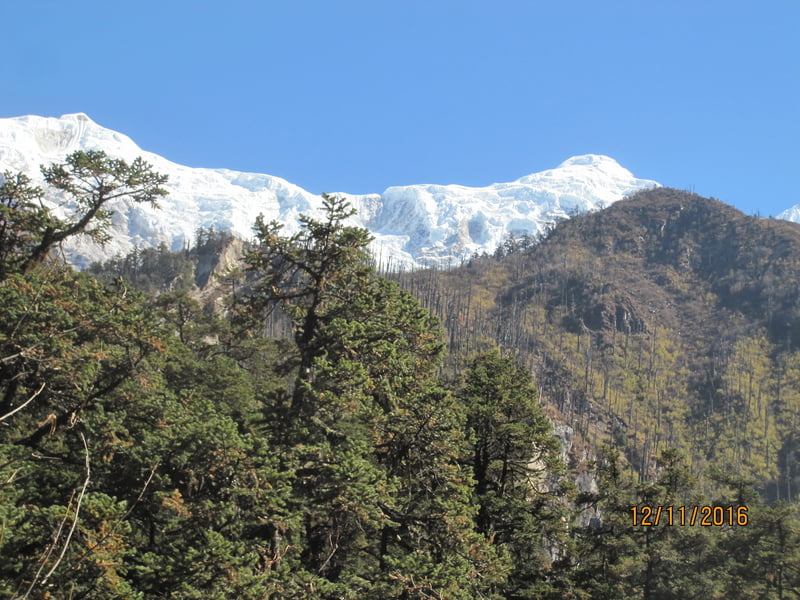
Take time for yourself and join us for this trek through the beautiful forests and lush landscape of Manaslu National Park. Visited by only a few tourists, this park is still unexploited by modern changes, and it is far less crowded than its more well-known peers Everest Base Camp and Annapurna Circuit.
Manaslu national park is home to diverse flora and fauna. During the trekking season, the trail is accompanied by lush rhododendron forests, birds chirping, and a kaleidoscope of butterflies. The trail comes to life with the warm sun and cool mountain breeze. Also on this trek, you will see the beautiful blue waters of the world’s highest lake – Tilicho Lake – at 4919 m.
Hurry up and experience this off-the-beaten track spot while it is still wild and relatively untouched!

43 years, Nepal
Guide
0
Hi I am Pasang Sherpa, professional outdoor leader based in Nepal. I provide trekking, mountaineering and mountain biking related holiday activities in Nepal. I have been working as trekking and biking guide since last 12 years. Working in the field of tourism and hospitality is not a job but a joy for me.
Nepal, Samagaun, Western Development Region, Gandaki
Kathmandu – Sotikhla (715 m)
Today we drive around 8 hrs drive to Sodi to start our trip.
Soti Khola – Labubesi / Machha Khola (870m)
Today, we start trekking in the morning. And after crossing the bridge, the trek climbs up onto a ridge above the huge rapids of Budhi Gandaki and reaches to Khorasani. Then, the trail, gets a bit precarious as it passes over a big rock and crosses a stream. The rocky trail then goes up and down through large stand of nettles, passes tropical waterfalls and again backs down to the bank of Budhi Gandaki.

Machha Khola – Jagat (1410m)
After a few more ups & downs, we reach to Tatopani. From the hot spring we climb over another ridge, then cross the Budhi Gandaki on a suspension bridge. Climb on over a ridge to Dobhan. Crossing a suspension bridge over the Dobhan Khola, the trail climbs on a rugged trail to Duman. we climb the stone stairs and then drop to the river and again climb more stone stairs to Tharo Bharyang. Trek along the Budhi Gandaki river then climb towards the village of Jagat.
Jagat – Ngyak (1950m)
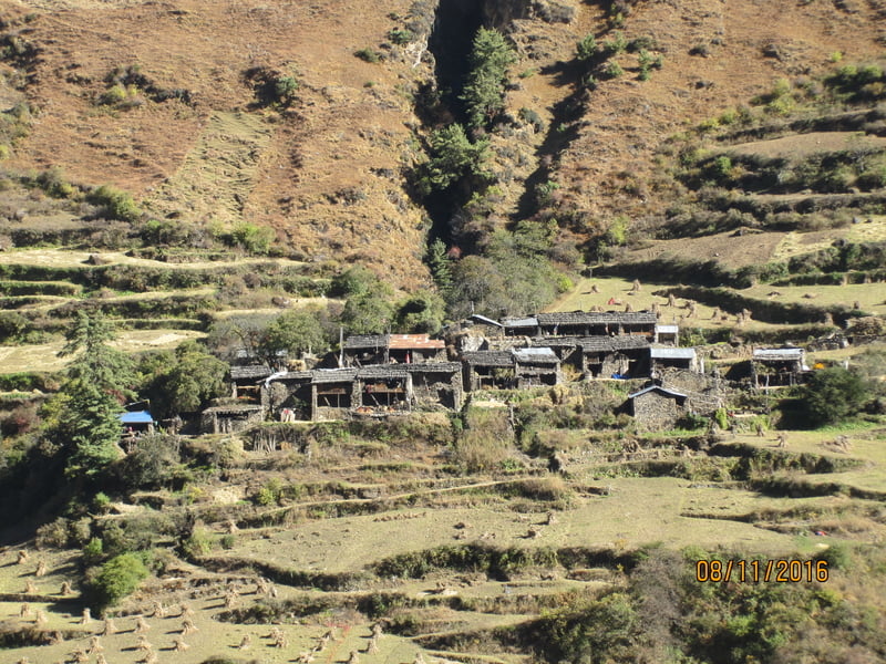
The day begins by following the river bank again for the first hour up to Ghata Khola. We then cross to the eastern bank before ascending to Philim, one of the few large settlements on this route and home to the Manaslu Conservation Area Project office.
Ngyak – Ghap (2050m)
The trek takes us through a heavily forested area in a narrow valley until we reach the little settlement of Dang. We then cross the Budhi Gandaki River where the valley opens and we begin our ascent to Rana.

Ghap – Lho (3148m)
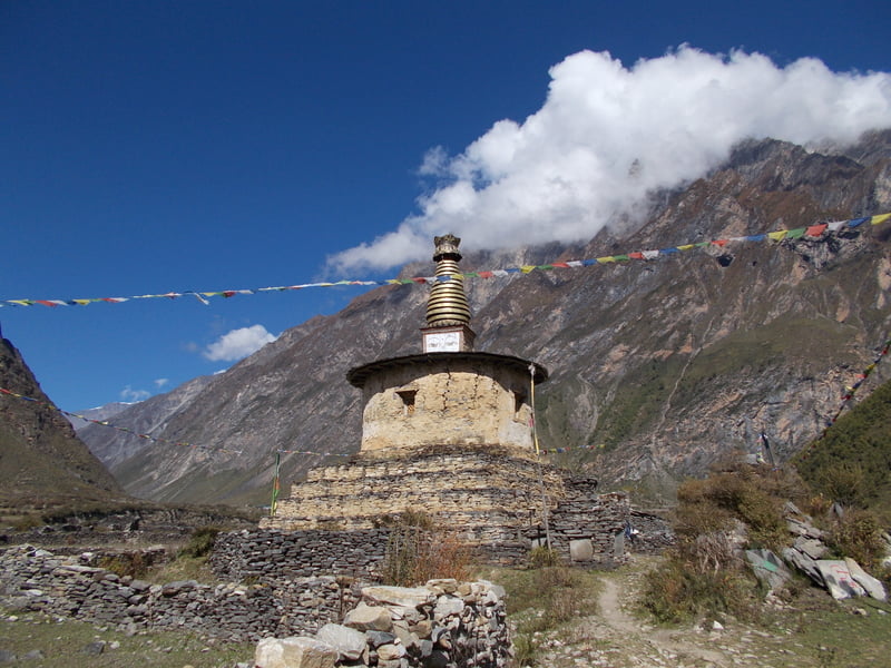
Slowly and gradually we gain altitude and enter into alpine territory. We also have increasing mountain views. On the way to Manurung, we find more Mani walls and three more crossings of the Budhi Gandaki. Finally, we reach Lho where we will stay overnight.

Lho – Samagaon (3517m)
Today, we resume the trek with a steep descent and a crossing of yet another rock-strewn torrent called Thusang Khola. You will realize that Manaslu and Himalchuli dominate the entire landscape. Then on, across the glacier-fed Numla Khola, the valley drops away to a moraine while we follow the ancient trans-Himalayan trail now just a few kilometers from Tibet.
Samagaon – Samdo (3738m)
Descend to the Budi Gandaki, which has turned north, and follow it to a bridge over a side stream. The trail to the left leads to the Manaslu Base camp. The Larkya la Trail passes several mani walls as the valley begins to widen. It is an easy trail on a shelf above the river passing the juniper and birch forests of Kermo Kharka. We drop off the shelf, cross the Budhi Gandaki on a wooden bridge and climb steeply onto a promontory between two forks of the river.
Rest day in Samdo (3738m)
Today, we will have full-day acclimatization at Samdo. We can explore the surrounding areas of Samdo today and stay here tonight.

Samdo – Dharmashala (4480m
Today’s walk starts easily enough. We cross Budhi Gandaki for a final time and pause at the old stone wall of mani inscriptions bidding us well for progress over the pass. The trail gradually rises through juniper and tundra with a viewpoint overlooking the Larkya La Glacier. Further climb will bring us to the memorable Spartan Larkya Rest House.

Dharamsala – Bintang (3890m), Larkya La Pass
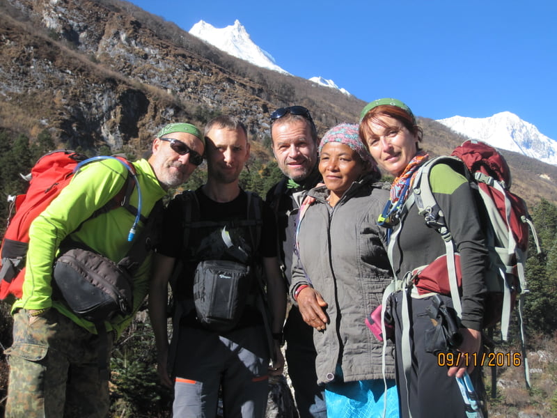
An early morning start is needed for what is to be a particularly tough and extended day. We start at approx. 4 am to avoid the gale force wind which usually gains in strength after mid-day at the pass. After a long gradual climb alongside a moraine, we make a short descent to a glacial lake and reach the head of the moraine (4700m) which we cross to climb to the ridge top. Four frozen lakes lie below and then it is up to the crest of the Larkya La (5100m). The reward for these difficult trekking conditions is brilliant westerly views of Himlung Himal, Kangguru and Annapurna II as well as the looming omnipresence of Manaslu. Well, the descent is hardly any easier; we drop around 650m in less than an hour.
Bhimtang – Tilje (3010m)
Trek goes along the Dudh Khola, a tributary of the Marsyangdi River, before arriving at the confluence in Dharapani Today the trail runs gently downstream of the river passing the village of Syange where we stay overnight.

Tilje – Stage (1725m)
Trek goes along the Dudh Khola, a tributary of the Marsyangdi River, before arriving at the confluence in Dharapani Today the trail runs gently downstream of the river passing the village of Syange where we stay overnight.

Syange – Kathmandu
After completing this wonderful Manaslu Trek, we today drive back to Kathmandu. After arriving at Kathmandu, in the evening, we will enjoy our farewell dinner party.

Users
average
|
Connect via: or
|
|
MOUNTAIN PLANET CONNECTS ADVENTURE GUIDES WITH OUTDOOR ENTHUSIASTS
Help us to make the mountains safer and more accessible to people by contributing secure information about routes, conditions, equipment and service providers
WHAT IS MOUNTAIN PLANET?
WHY SHOULD I REGISTER/SIGN UP?
|
We use cookies to enhance your visit to our site.