
Route
Mt. Shivling Base Camp
| Mountain: | Mt. Shivling (6 543 m / 21 467 ft) |
| Activity type: | Hiking |
| Activity level: | Challenging |
| Elevation: | 4 572 m / 15 000 ft |
| Duration: | 7 Day(s) |
| Expenses: | from$ 500 |

Overview
| Route Name: |
Mt. Shivling Base Camp, Gaumukh -Tapovan Circuit, Ganges Glacier Trek |
| Activity type: |
Hiking |
| Activity level: |
Challenging |
| Type of Climb: |
Trekking |
| Location: |
Asia, India |
| Starting Point: | |
| Parent Range: | Please update |
| Mountain: | |
| First Ascent: | Please update |
| Duration: |
7 Day(s) |
| Max. Elevation: |
4 572m / 15 000 ft |
| Vertical Gain: | Please update |
| Length: |
57km / 35 miles |
| Climbing Season(s): |
28 Apr-04 May; |
| Nearst Airport(s): |
|
| Convenience Center(s): | |
| National Park(s): |
Please update |
Last update:
(16 Feb 2017) • History
0 climber who were here
Day 1
Dehradun – Uttarkashi – Gangotri
Uttarkashi is one of the major towns of Uttarakhand thus buses and shared cabs are easily available from Dehradun. You can board shared cabs to Uttarkashi from Rispana Pul in Dehradun. This 5-6hrs drive passes through Mussoorie Bypass Road offering scenic views. The massive Tehri Dam Lake also comes into view as you proceed towards Chilyanisaur.
After a short break at Uttarkashi continue another 4 hour drive to reach Gangotri via Harsil. If you start from Dehradun at around 6am then you will probably reach Uttarkashi by 12 Noon. Take another shared cab to Gangotri from Uttarkashi. Perform evening aarti at Gangotri Temple and obtain the permits to enter Gangotri National Park. Overnight in Hotel.
Day 2
Day 02: Gangotri – Chirbasa – Bhojbasa
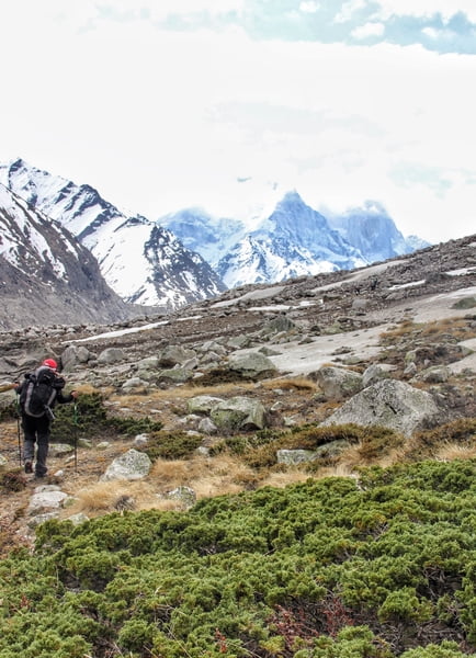
Visit the sacred shrine of Goddess Ganga and buy all the necessary items from the market. The trek starts with a decent trail and it remains the same till further 2kms where you need to show permits. As you walk deep into the valley the vegetation also decreases. Continue trekking to reach Chirbasa which is situated 9kms from Gangotri Town. Cross small streams en route to Chirbasa. Chirbasa is a good campsite and the last point where you’ll see good vegetation. You can camp here if there are any signs of AMS. Chirbasa is situated at an elevation of 3, 580mts above sea level.
Bhojwasa is located 5kms from Chirbasa. Bhagirathi Peaks stands high above the ground and is constantly visible during the trek. The trail not only goes through rugged terrains along with the Bhagirathi River but also climbs up to rugged mountains. Bhojbasa is a vast open expanse of land in the valley, situated at an elevation of 3,800mts above sea level. You can visit ashrams at Bhojwasa to perform aarti or stroll around the Bhagirathi River, gazing at Bhagirathi Peaks in total awe.
Day 3
Bhojbasa – Tapovan
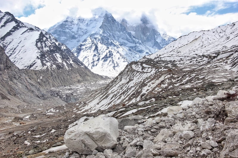
There are two routes by which you can reach Tapovan. First one being the classic route via Gaumukh Glacier for which you need to follow the trail going to Gaumukh which can be seen on the left side from Bhojwasa. Gaumukh Glacier is 5kms from Bhojwasa. Then you need to traverse the glacier and climb the unapologetically steep rugged wall to reach Tapovan. The second route requires crossing Bhagirathi River from Bhojwasa itself. You need to walk on moraines for many kilometers with constant view of Gaumukh Glacier from distant. Climb the ridge covered with snow to reach Tapovan.
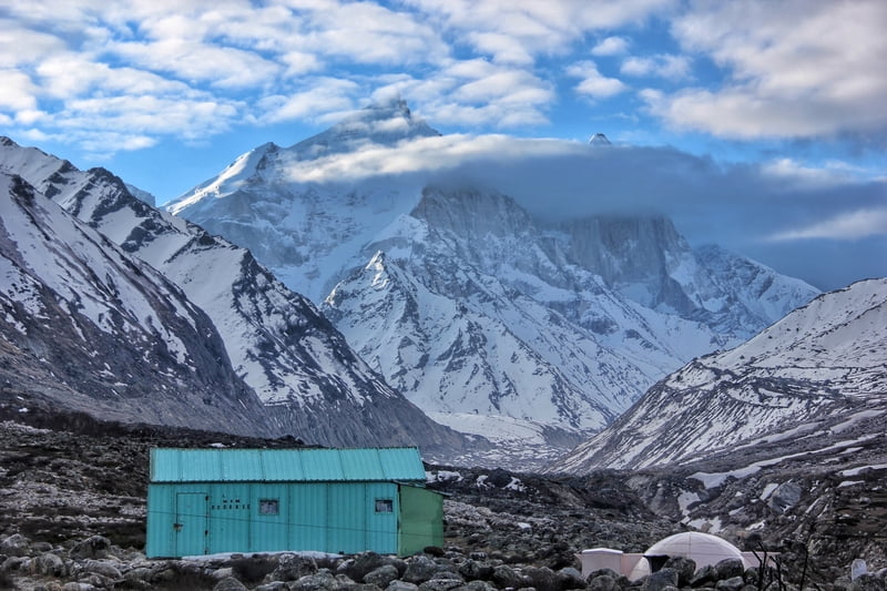
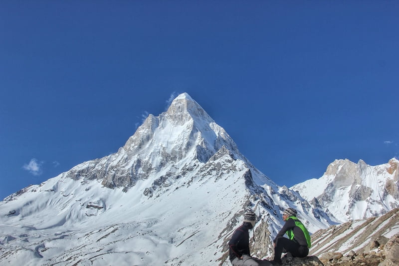
Tapovan campsite is located at the foot of Mount Shivling (6,543 mts), just a glance of this mountain is a priceless gift of this trek. And if Shivling peak is not enough then Kharchkund & Meru Peak will definitely leave you speechless. Tapovan is situated at 4400mts above sea level.
Day 4
Tapovan – Nandanvan
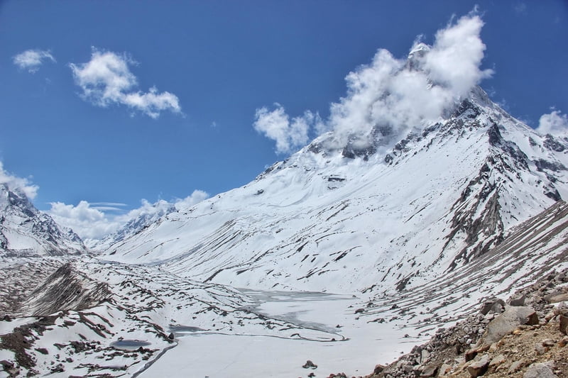
This trekking stretch involves long walk over exposed glacier so start early in the morning. The trek starts with steep descent from Tapovan to reach the glacier and ends with steep climb of approximately 100mts to reach Nandanvan.
The view of Shivling peak from Nandanvan is a lot different than what is visible from Tapovan and both the views are awe-inspiring. Crossing the massive Gaumukh Glacier is the highlight of this trek. Nandanvan is situated at 4450mts above sea level.
Day 5
Nandanvan – Gaumukh – Bhojwasa
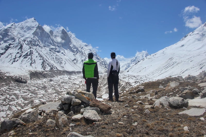
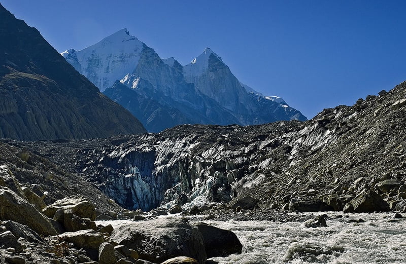
The trek starts off with rugged terrains and moraines. Descent on moraines will require extra attention from your legs while trekking. Trek slowly and take a break after you reach the snout of Gaumukh Glacier to experience its massiveness. This is the point where the holy Ganges emerges from, it all begins here. Further trek down to reach Bhojbasa .
Day 6
Bhojbasa – Chirbasa – Gangotri
Gangotri National Park is rich in wildlife and you will most likely see herd of Bharal’s (Blue Sheep) grazing on the ridges. Enjoy the last kilometers of the trek from Bhojbasa to Gangotri. If you reach Gangotri at around noon and wish to continue traveling till Uttarkashi then you can hire a cab. But don’t forget to pray at Gangotri Temple after returning.
Day 7
Gangotri – Uttarkashi – Dehradun
Drive back to Dehradun
Sort by:
show:
- 6
- 18
- 36
|
Availability
|