Route

Passo de Jama - Cerro Zapaleri, Cerro Zapaleri (5 653 m / 18 547 ft)

Mountain: Cerro Zapaleri (5 653 m / 18 547 ft)
Activity type: Mountaineering
Activity level: Challenging/ Tough
Elevation: 5 653 m / 18 547 ft
Duration: 7 Day(s)
Expenses: Please update

Overview

Route Name:
Passo de Jama - Cerro Zapaleri, 7 day Atakama treking Passo de Jama - Cerro Zapaleri - Passo de Jama
Activity type:
Mountaineering
Activity level:
Challenging/ Tough
Type of Climb:
Trekking
Location:
South America, Argentina, Bolivia, Chile
Starting Point:
Parent Range:
Mountain:
First Ascent:
13/1/2018
Duration:
7 Day(s)
Max. Elevation:
5 653m / 18 547 ft
Vertical Gain:
1 553m / 5 095 ft
Length:
150km / 93 miles
Climbing Season(s): Please update
Nearst
Airport(s):
Please update
Convenience Center(s): Please update
National
Park(s):
Please update

Location

South America, Argentina, Bolivia, Chile
  • Your Chance To Edit •  Add / Share you knowledge with mates

    Loneliness and the most beautiful and closest stars.
  • Description Edit •  Add / Share you knowledge with mates

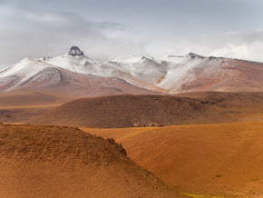
    It is a 7 day hike cross a 5000+ mountain rage through small deserts. Water is sometimes to be carried with and the trail planned closer to mountains for this sake. Takes 3 days getting from Passo de Jama to Zapaleri foot day to climb a mountain and 3 days back. I made it solo.
  • Getting There Edit •  Add / Share you knowledge with mates

    I got there from Jujuy by a public buss by ruta 52, that clibs as high as 4100 m
  • Are You Ready? Edit •  Add / Share you knowledge with mates

    You have to be physically and psychologically prepared. It is high altitudes you get from very start. and then the mountain ranges to cross
  • Tips Edit •  Add / Share you knowledge with mates

    Cellular Network: No


  • Parameters Edit •  Add / Share you knowledge with mates

    Base Camp Elevation: 4 440 m / 14 567 ft
    Summit Camp Elevation: 4 440 m / 14 567 ft
    Accommodation in Base Camp: Tents only
    Accommodation above Base Camp: Tents only
    Number of Camps: 1
    Avg. Cost: Please update
    Age Restrictions: At least 21 years old
    Soloing: Yes
    Descent Route: Same
    Specify descent time: 4 Hour(s)
  • Key Points Edit •  Add / Share you knowledge with mates

    Name (Elevation) Description
  • Agencies Edit •  Add / Share you knowledge with mates

  • GPS-Tracks

    zp_d1.kmz
    gps-avatar
    Gundars Bojārs
    150 download(s)
    zp_d2.kmz
    gps-avatar
    Gundars Bojārs
    147 download(s)
    zp_d3.kmz
    gps-avatar
    Gundars Bojārs
    163 download(s)
    zp_d4.kmz
    gps-avatar
    Gundars Bojārs
    157 download(s)
    zp_d5.kmz
    gps-avatar
    Gundars Bojārs
    157 download(s)
    zp_d6.kmz
    gps-avatar
    Gundars Bojārs
    145 download(s)
    zp_d7.kmz
    gps-avatar
    Gundars Bojārs
    150 download(s)
    Add
  • Did You Know Edit •  Add / Share you knowledge with mates

    January is the best season because of the "rainy season". It sometimes can snow or thunderstorm in the mountains, so you have some water availability.


  • References Edit •  Add / Share you knowledge with mates

Last update: Gundars Bojārs (11 Jun 2018) • History
No one has been added yet

1 climber who were here

Sort by:

show:

  • 6
  • 18
  • 36

Join the growing Alpine Community now.