Route

Leuthold Couloir Route, Mount Hood (3 429 m / 11 250 ft)

Mountain: Mount Hood (3 429 m / 11 250 ft)
Activity type: Mountaineering
Activity level: Challenging
Elevation: 3 429 m / 11 250 ft
Duration: 2 Day(s)
Expenses: from$ 800
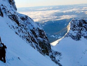
Image of Leuthold Couloir Route, Mount Hood (3 429 m / 11 250 ft)
Credit: www.mountainproject.com

Overview

Route Name:
Leuthold Couloir Route, West Face route
Activity type:
Mountaineering
Activity level:
Challenging
Type of Climb:
Snow & Ice
Location:
North America, United States (USA): (Oregon)
Starting Point:
Parent Range:
Mountain:
First Ascent:
4/9/1932 Ralph Calkin , Jim Mount
Duration:
2 Day(s)
Max. Elevation:
3 429m / 11 250 ft
Vertical Gain: Please update
Length: Please update
Climbing Season(s):
01 Apr-30 Jun;
Nearst
Airport(s):
Convenience Center(s):
National
Park(s):

Location

North America, United States (USA): (Oregon)
  • Your Chance To Edit •  Add / Share you knowledge with mates

    The Leuthhold Couloir is located on the West Face of Mount Hood. This is a high quality intermediate route with steep snow climbing. The route crosses over the Reid Glacier making both crevasse rescue and ice axe skills mandatory. The views on the Leuthhold are quite good including Illumination Rock, the Reid Headwall, Yucum Ridge, Crater Rock, the Hogsback and more.
  • Description Edit •  Add / Share you knowledge with mates

    This is a fine route that opens up spectacular views of the Reid glacier and inspiring views of Yokum Ridge. While technically it doesn't require much more skill than the southside route, the Leuthold's couloir route entails crossing some crevassed terrain and avalanche prone slopes. The usual start is the same as South side routes. As you pass the Silcox hut begin to gradually trend left heading towards llumination saddle formed by a large noticeable rock on SE side of Mountain. After crossing over the saddle drop down onto the Reid glacier. As you drop down traverse to the right toward Yokum Ridge. Pass several couloirs on the right until you basically hit the steep wall of Yokum ridge. Once there turn right and enter into Leuthold couloir proper. Follow the couloir as it narrows and winds up the mountain. As the couloir ends and opens up continue up easy slopes to the summit ridge and onto the summit.
  • Getting There Edit •  Add / Share you knowledge with mates

    Getting There from Portland: From I-5 take exit onto I-84 east for 12.8 miles. Take a right at exit 16 onto 238th Dr. Continue on NE 242nd Dr (road changes name). At about 3.4 miles from I-84 turn left onto E Powell Boulevard. This road turns into US-26 E/Mt Hood Hwy. In 38.9 miles turn left onto Timberline Highway. This will take you all the way to the Timber Lodge parking lot (end of the road) which is the starting spot for this route.
  • Are You Ready? Edit •  Add / Share you knowledge with mates

  • Tips Edit •  Add / Share you knowledge with mates

    Cellular Network: No (Guided Tours)


  • Parameters Edit •  Add / Share you knowledge with mates

    Base Camp Elevation: Please update
    Summit Camp Elevation: Please update
    Accommodation in Base Camp: Please update
    Accommodation above Base Camp: Please update
    Number of Camps: Please update
    Avg. Cost: 800 USD
    Age Restrictions: Please update
    Soloing: Please update
    Descent Route: Same
    Specify descent time: Please update
  • Key Points Edit •  Add / Share you knowledge with mates

    Name (Elevation) Description
  • Agencies Edit •  Add / Share you knowledge with mates

  • GPS-Tracks

    Add
  • Did You Know Edit •  Add / Share you knowledge with mates

  • References Edit •  Add / Share you knowledge with mates

Last update: Anastasia Pivnyuk (10 Dec 2016) • History
No one has been added yet

0 climber who were here

Sort by:

show:

  • 6
  • 18
  • 36

Join the growing Alpine Community now.