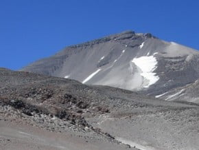
Normal Route, Ojos del Salado (6 893 m / 22 615 ft)
| Mountain: | Ojos del Salado (6 893 m / 22 615 ft) |
| Activity type: | Mountaineering |
| Activity level: | Moderate/ Challenging |
| Elevation: | 5 900 m / 19 357 ft |
| Duration: | 6 Day(s) |
| Expenses: | from$ 2 300 |
Overview
| Route Name: |
Normal Route, Ruta Normal, routa normale, Стандартный Маршрут |
| Activity type: |
Mountaineering |
| Activity level: |
Moderate/ Challenging |
| Type of Climb: |
Trekking |
| Location: |
South America, Chile: (Atacama) |
| Starting Point: | |
| Parent Range: | |
| Mountain: | |
| First Ascent: |
26/2/1937 Jan Szczepanski (Poland), Justyn Wojsznis (Poland) |
| Duration: |
6 Day(s) |
| Max. Elevation: |
5 900m / 19 357 ft |
| Vertical Gain: |
1 693m / 5 554 ft |
| Length: |
7km / 4 miles |
| Climbing Season(s): | Please update |
| Nearst Airport(s): |
|
| Convenience Center(s): | |
| National Park(s): |
Please update |
Location: Argentina
Activity type:Mountaineering
Difficulty: Tough/ Extreme
Drive up to Atacama Camp, at 5 200. Driving looks like a high altitude safari than a regular drive. Make a stop before arriving at base camp and take a short walk up to 1-2 kilometers - it improves your acclimatization.
Acclimatization hike and carry loads to High Camp, Refuge Tejos, at 5 900. Perhaps this shelter is the highest mountain hut in the world! You'll cache your stuff at the hut and then go back down to the base camp. Approach time is very depends on your acclimatization but usually takes up to 5 hours.
Move to Refugio Tejos, where you'll spend the night before summit push. It is a short day - you'll arrive early, get hydrated, eat and rest for the summit day.
Wake up very early in the morning and climb up to 8-12 hours to the summit. The terrain may be snowy or dry. From the summit you'll have an amazing view over all major summits in the area, including Tres Cruces and Mount Pissis. Descent back and overnight at the high camp Refuge Tejos.
Move to the base camp Refuge Atakama and further to Copiapo.
Spare day in case of bad weather.
show:
- 6
- 18
- 36
|
Availability
|


