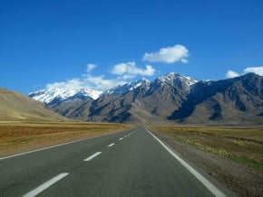
Range
Verified
Zagros mountains
| Region(s): |
Asia, Iran: (Bushehr, Fārs, Ostān-e Chahār Maḩāl va Bakhtīārī, Ostān-e Hamadān, Ostān-e Īlām, Ostān-e Kermānshāh, Ostān-e Kohgīlūyeh va Bowyer Aḩmad, Ostān-e Lorestān), Iraq: (Dihok, Muḩāfaz̧at Arbīl, Muḩāfaz̧at as Sulaymānīyah) |
| Parent Range: | |
| Max. Elevation: | 4 548 m / 14 921 ft |
| Geology: | Tectonic |
| Average Length: | 776 miles / 1 250 km |
| Average Width: | 300 miles / 186 km |
Overview
| Range Name(s): |
Zagros mountains |
| Max. Elevation: |
4 548 m / 14 921 ft |
| Region(s): |
Asia |
| Location: |
Asia, Iran: (Bushehr, Fārs, Ostān-e Chahār Maḩāl va Bakhtīārī, Ostān-e Hamadān, Ostān-e Īlām, Ostān-e Kermānshāh, Ostān-e Kohgīlūyeh va Bowyer Aḩmad, Ostān-e Lorestān), Iraq: (Dihok, Muḩāfaz̧at Arbīl, Muḩāfaz̧at as Sulaymānīyah) |
| Activity type: | Please update |
| Starting Point: | |
| Parent Range: | Please update |
| Geology: |
Tectonic |
| Snow line: | Please update |
| Average Length: |
776 miles / 1 250 km |
| Average Width: |
300 miles / 186 km |
| Nearst Airport(s): |
Please update |
| Convenience Center(s): | Please update |
| National Park(s): |
Please update |
Location
Asia, Iran: (Bushehr, Fārs, Ostān-e Chahār Maḩāl va Bakhtīārī, Ostān-e Hamadān, Ostān-e Īlām, Ostān-e Kermānshāh, Ostān-e Kohgīlūyeh va Bowyer Aḩmad, Ostān-e Lorestān), Iraq: (Dihok, Muḩāfaz̧at Arbīl, Muḩāfaz̧at as Sulaymānīyah)
Last update:
Slava Shevtsov
(02 Jul 2018) • History
No one has been added yet
0 climber who were here

