

1 elements (1 brands)
Created: Alex Kurlian
Last update: 06 Apr 2018
| Activity type: | Hiking |
| Activity level: | Easy/ Moderate |
| Availability: |
30 Jul 2018 - 10 Aug 2018 |
| Duration: | 11 Day(s) / Tour with fixed start dates |
| Price: | from $300 |
To participate in this campaign it is recommended to have experience of hiking and / or good physical shape.
Trekking on loads of moderate complexity. Beginners can be hard. Without experience, you can get by if you are really in good physical shape, exercise regularly. In general, the route is recommended for participants with experience.
Weather conditions: in summer on sunny days it's warm and even hot, you need to use a suntan cream, you can wear shorts and T-shirts. In cloudy and windy weather can be quite cool, you need a fleece and windbreaker. At night, the temperature can drop to zero degrees.
The route passes along trails, snowfields, along grassy and stony plots without trails.
Omissions. The route passes through the territory of the reserve and along the border zone. It is necessary to make passes: citizens of the Russian Federation for 30 days, foreign citizens, 60 days before the start of the campaign (passes we draw up). Plan your holiday in advance!
In case of bad weather and based on other rational factors, the instructor has the right to make adjustments to the schedule.
37 years, Russia
Guide
950
6 years expirience mountain guide, worked regions: Altai, Caucasus in Russia, Yunnan in China, also Iran, Spain, Turkey, Myanmar
Russia, Bezengi, Kabardino-Balkaria, Chereksky District
Mineralnye Vody - Upper Balkaria - the river Chinaszki
Arrival by train or plane to the city of Mineralnye Vody.
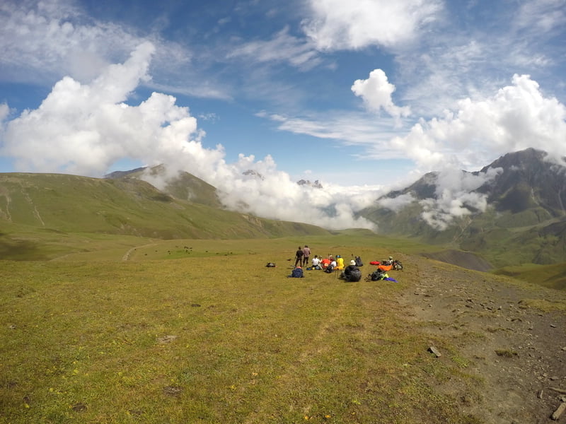
Meeting the group in the morning at the station near the monument with an eagle. We drive on the ordered vehicles to the village of Verkhnaya Balkaria, the starting point of the pedestrian part of our route. We rise with backpacks in the valley of the river Chinashki, where we get up for the night.
We put tents, prepare dinner, we conduct group acquaintance at the fire.
Go 3 km, climb 200 meters.

river Chaynashki
Today we have to climb the valley of the river Chinaszki. It will be a little difficult, but we will manage. And already admire the beautiful scenery.
The transition is 16 km, climbing 1000 meters.
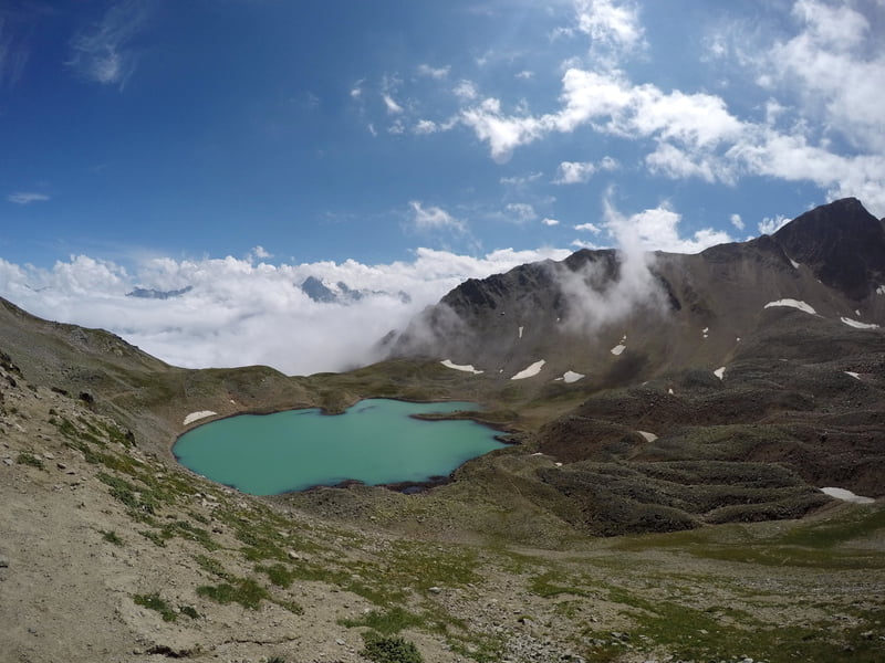
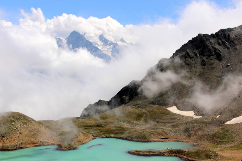
The river Chynyashki - Lake Guybashkol
First we rise to the upper reaches of the river Chinashki, we cross the pass Shepherd, and finally, we see Lake Guibaschkol. And with good weather, we also bathe!
Going 14 km, elevation 900 meters.
The Chynyashka River - Dumala Pass 2977 m) - Dumala river
We climb to the pass Dumala (2977m). From here you can see the grandiose peaks: Koshtantau, Ulluauz, Dumala. We are photographed and begin the descent along the river Kyuchmesu to the valley of the river Dumala, where we get up for the night.
Going 14 km, set 600 meters of height, loss of height of 800 m.
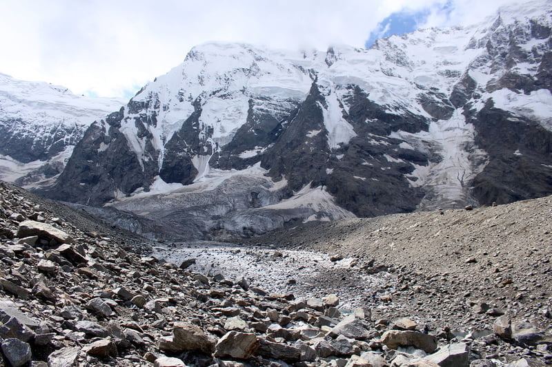
Upper part of the valley of Dumala
Today is an easy day. We will make a radial exit (without backpacks) to the upper reaches of the valley of Dumala. We'll look closer to the snow-capped peaks and the Ulluauz glacier surrounding us, slipping from them to our valley.
Go 20 km, climb 600 meters.
Dumala - the river Cherek Bezengiysky - Bezengi camp
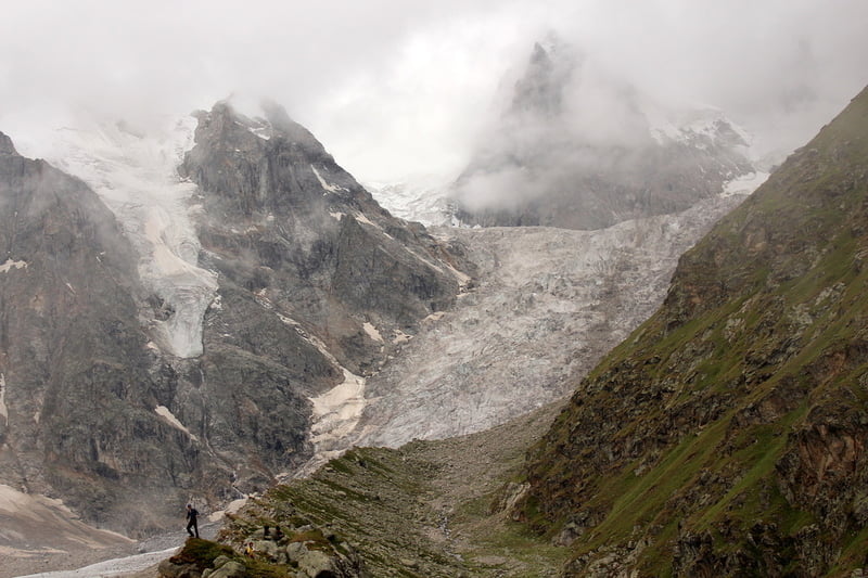
We descend down the valley of the river Dumala. At the end of the valley we are waiting for a sharp descent through the forest, but it's good that there is a trail here. Descending to the valley of Cherek Bezengiysky, in the north we will see Gestola - one of the peaks of the famous Bezengiyskaya wall.
Next, we have a long way up the valley to the alpine camp "Bezengi", where we are waited for by a plentiful dinner (cook together, at the stake or on gas burners). We put tents in specially designated territory. If possible, there will be a sauna or a warm shower.
The passage is 7 km.
Alpine camp
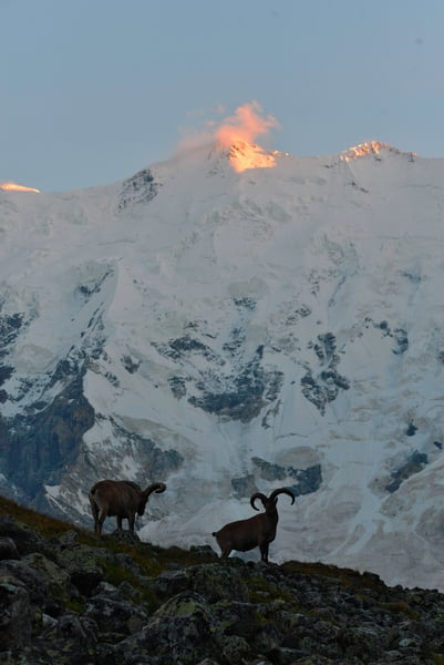
Wake up in the alp camp. Today again an easy day is a radial exit to the glacier of Mizhirghi. Before us in all its glory will be the Northern Massif, led by three five-thousanders: Dykhtau (the second peak of the Caucasus after Elbrus), Koshtantau and Mizhirga. Great landscape for cool photos!
The transition is 10 km, climbing 700 meters.
Alpine camp
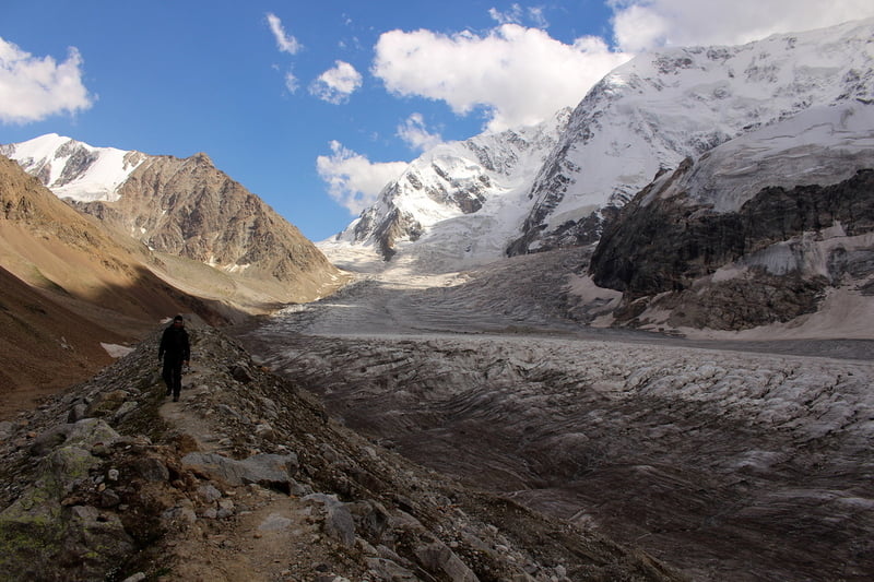
Today we leave the alpine camp and again go with backpacks. We leave on the biggest glacier of the area - Bezengiysky.
We pass check at frontier guards, after all we come in a boundary zone, and for half a day we reach Baran-Kosha.
Go 8 km, climb 500 meters.
Baran-Kosh - Jangi-Kosh - Baran-Kosh
Early rise. We leave for the radialka, with light rucksacks and a snack. We are waiting for the Bezengi wall. We will see the famous peaks of the Caucasus - Shkhara, the peak of Shota Rustaveli, Katyntau, Dzhangitau and others.
In the evening we return back to Baran-Kosh.
Go 12 km, climb 500 meters.
Baran-Kosh - Alpine camp Bezengi
We remove tents and go down to the alpine camp "Bezengi". You can arrange a bath and farewell dinner.
The crossing is 8 km.
Back to Mineralnye Vody
We gather camp, have breakfast, feel how sorry it is to leave. The last look at the mountains ... and leave for Mineralnye Vody, where we arrive after 14 hours.
In case of bad weather and based on other rational factors, the instructor has the right to make adjustments to the schedule.

Users
average
|
Connect via: or
|
|
MOUNTAIN PLANET CONNECTS ADVENTURE GUIDES WITH OUTDOOR ENTHUSIASTS
Help us to make the mountains safer and more accessible to people by contributing secure information about routes, conditions, equipment and service providers
WHAT IS MOUNTAIN PLANET?
WHY SHOULD I REGISTER/SIGN UP?
|
We use cookies to enhance your visit to our site.