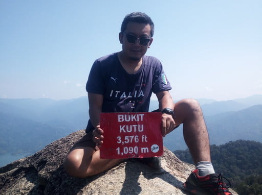
Bukit Kutu Hike
| Activity type: | Hiking |
| Activity level: | Easy |
| Availability: |
15 Jan 2020 - 30 Nov 2020 |
| Duration: | 1 Day(s) / Tour with flexible start dates |
| Price: | from $60 / Negotiable |
Full description
Bukit Kutu is a mountain 1053 meters tall located at the town of Kuala Kubu Bharu, Selangor, Peninsular Malaysia. Although it is called as “Bukit” which stands for “Hill” in Malay, the climb up takes approximately 3-4 hours with certain steep section. The summit is a boulder which offers a panoramic view of clouds, valleys and mountains.
Starting from the carpark which has an elevation of 250 meters, the 6km hiking trail to Bukit Kutu summit (1053 meters tall) takes approximately 3-4 hours, climbing up an elevation of 800 meters.
The trail can be split into two parts. The first part – walking to the foot of Bukit Kutu and the second part – the actual climbing of Bukit Kutu.
The first part – walking to the foot of Bukit Kutu, is approximately 1.5km long and takes about 30 to 45 minutes to complete. Always take the trail on your right if you come into a diversion. There will be three river crossing along the way. The first river4 has a suspended bridge linking up both banks. The second river5 has a broken half submerged bridge, cross with care. The third river does not have a bridge, just walk into the water to get across. After crossing the third river, you will see a yellow sign7 board with the words “Hutan Simpanan Kekal” which means reserved forest. The hike to Bukit Kutu begins.
The second part – actual climbing of Bukit Kutu begins after the yellow signboard and is approximately 4.5km long to the summit. After about 15mins of hiking from the yellow signboard, you will need to cross a small stream. After the stream, the actual ascends begins. There are 9 checkpoint along the way, C1 to C9, and the first four checkpoint are the hardest and steepest part of the entire climb. En-route, there are also many fallen bamboos which you will either need to climb over or under it. Between C4 to C5 is a very very tall stone wall which marks the halfway point. The climb become less steep after the half way mark. When you see the chimney, you are nearing the summit. Take the path on the right of the chimney to go to the summit boulder. Carefully climb up 4 flights of ladders to be at the top of the summit boulder.
Price includes
- Entrance permit
- Basic first aid
- GPS
- Fly and ground sheet
Not included in price
- personal food and drink
- insect repellent
- raincoat
- hiking gear
Guide
- Email address
- Phone number
I'm dedicated to keeping my clients safe and secure and trained to minimize climbing/hiking risks while maximizing client enjoyment.
Location
Malaysia, Selangor
Users
average

