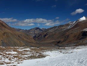
Trekking around Dhaulagiri, Himalaya
| Mountain: | Dhaulagiri (8 167 m / 26 795 ft) |
| Activity type: | Hiking |
| Activity level: | Challenging |
| Elevation: | 5 360 m / 17 585 ft |
| Duration: | 12 Day(s) |
| Expenses: | from$ 1 500 |
Overview
| Route Name: |
Trekking around Dhaulagiri, Dhaulagiri Circuit, Dhaulagiri trek, Around Dhaulagiri trek, Треккинг вокруг Дхаулагири |
| Activity type: |
Hiking |
| Activity level: |
Challenging |
| Type of Climb: |
Trekking |
| Location: |
Asia, Nepal: (Western Region) |
| Starting Point: | |
| Parent Range: | |
| Mountain: | |
| First Ascent: |
1/1/2015 |
| Duration: |
12 Day(s) |
| Max. Elevation: |
5 360m / 17 585 ft |
| Vertical Gain: |
4 530m / 14 862 ft |
| Length: |
105km / 65 miles |
| Climbing Season(s): |
01 Mar-31 May; 01 Sep-30 Nov; |
| Nearst Airport(s): |
|
| Convenience Center(s): | |
| National Park(s): |
0 climber who were here
Beni – Tatopani / Babiyachaur. On your way from Beni to Tatopani you cross a lot of villages and rice fields. The trail goes along the road first, but then joins it. You can continue till Babiyachaur, if you have enough time.
Tatopani – Dharapani. The dirty road continues till Darbang. You can reach it with a local bus, if you'd like. It will save 1,5-2 days of trekking. In Darbang there is an ACAP checkpoint. After Darbang the valley turns to the North. The trail on the right bank of the river goes with ups and downs. There is an alternative flatter trail on the left bank of the river. These trails meet in Naura.
Dharapani – Muri. The trail is very good. In the end there is a descent (about 400 m) to cross the river Dara Khola, and then rather steep ascent (the same 400 m) to the level of Muri.
Muri – Boghara. First an uncomfortable descent through the rice fields to cross Muri Khola. Then a steep ascent. These trails can be very slippery in rainy weather. Then till Naura the trail goes along the Myagdi Khola through the forest. And after Naura there is a gentle ascent till Boghara.
Boghara – Dobang. The trail is passing through the forest. It can be muddy in rainy weather. There is a path carved into the rock. It's quite wide and is not a problem. However it can be very slippery if wet. Dobang is a haven, not a village. You can get here a meal during the season.
Dobang – Italian base camp. The trails goes gently up through the forest. It can be muddy. After Choriban (a refuge where you can order some meal) the trail goes up from the river Myagdi Khola and then crosses the steep slope with bamboo forest to the Italian base camp.
Acclimation day at Italian base camp.
Italian base camp – Glacier base camp. There is a tricky passage after the Italian BC: steep descent, then steep ascent on the opposite side and crossing the steep slope by a narrow path. This part can be dangerous of falling stones, not stable path and snow clouds from near avalanches. It's better to walk through it early in the morning. Then the trail goes on the bottom of the gorge and then goes to the glacier which is covered with stones and rubble, and leads ti tje Glacier BC. It is on the left of the path and it is made up of locations surrounded by small stone walls. There are also baskets that serve as trash.
Glacier base camp – Dhaulagiri base camp. The clearly visible path goes exclusively on the glacier that is still covered with rubble and stones and leads to the Dhaulagiri BC at 4700 m. It is clearly identifiable through the baskets and stone places arranged.
Dhaulagiri base camp - the French Pass – Hidden valley. First the trail continues by the glacier, then does up to the ledge, croses the snow field and leads to a short but steep ascent to the seddle of the French pass. It can be really difficult because of the snow. Decent from the pass by the glacier is not a problem. The night temperature in the Hidden valley can low to -25 °С.
Hidden valley - the Dhampus Pass – Yak Kharka. The path to the Dhampus Pass is markes with cairns, but still iy can be tricky to find it and the best way to the pass. The ascent is gentle and can be snowy. The descent is rather steep, first along snowy slopes. The the trail leads to rubble slopes, and then goes down and can be lost in the maze of yak trails.
Yak Kharka – Marpha - Jomsom. A very steep and long descent to Kali Gandaki valley. The main trail is well marked. From Marpha to Jomsom you can get trekkong or by a jeep.
show:
- 6
- 18
- 36
|
Availability
|

