Range

High Atlass

Region(s): Africa, Morocco: (Marrakech-Tensift-Al Haouz)
Parent Range: Atlas Mountains
Max. Elevation: 4 167 m / 13 671 ft
Geology: Tectonic
Average Length: 435 miles / 700 km
Average Width: 100 miles / 62 km
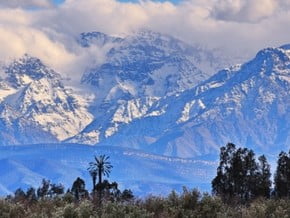
Image of High Atlass
Credit: www.trekearth.com

Overview

Range Name(s):
High Atlass
Max. Elevation:
4 167 m / 13 671 ft
Region(s):
Africa
Location:
Africa, Morocco: (Marrakech-Tensift-Al Haouz)
Activity type:
Mountaineering, Hiking, Backcountry Skiing
Starting Point:
Parent Range:
Geology:
Tectonic
Snow line:
4 000 m / 13 123 ft
Average Length:
435 miles / 700 km
Average Width:
100 miles / 62 km
Nearst
Airport(s):
Convenience Center(s):
National
Park(s):

Location

Africa, Morocco: (Marrakech-Tensift-Al Haouz)
  • Your Chance To Edit •  Add / Share you knowledge with mates

    The highest peak of North Africa and Morocco is located here, as well as a large number of trekking routes, including Grand Toubkal Loop.
  • Description Edit •  Add / Share you knowledge with mates

    The west part of the ridge consists mainly of plateaus surrounding the central granite massif, which includes Mount Toubkal (4165 m). The central part is similar to the Colorado Plateau and canyons landscape stretches from Azilal to Ouarzazate. Mountain plains are located at altitudes of 2500 m, several peaks exceeding 4000 m highest mountain of this area - Jebel Mguni (4068 m). The eastern part of the ridge height is much lower (up to 1500 m). The most popular areas for trekkers in High Atlas are: The Toubkal region, M’Goun Massif, Jebel Sahro, Jebel Sirwa and the Amezmiz Plains. This is the most popular area with trekkers : easily accessible from Marrakech, it is an area of stunning scenery, high mountains (including Toubkal, the highest mountain in north Africa at 4167m) and typical Berber villages. The area is criss-crossed by mule tracks that cross high passes and descend into deep valleys, passing summer pastures and terraces of maize. Imlil is the main trailhead for the area.
  • Location Edit •  Add / Share you knowledge with mates

    The highest peak of North Africa and Morocco is located here, as well as a large number of trekking routes, including Grand Toubkal Loop.
  • Did You Know Edit •  Add / Share you knowledge with mates

    The mountains formed over millions of years, gaining their present-day shape when the African continent collided with the Iberian peninsula, in what is known as a convergent plate boundary.


  • References Edit •  Add / Share you knowledge with mates

Last update: Anastasia Pivnyuk (24 Nov 2016) • History
No one has been added yet

4 climber who were here

Join the growing Alpine Community now.