Sun Bum Lip Balm SPF 30+ - Sunscreen
Sun Bum

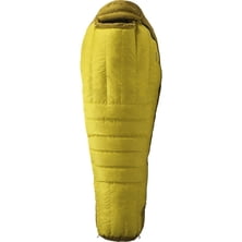
Material: 99% cotton twill, 1% spandex Fit: straight leg Inseam: 32 in Leg Opening: 16 in Waist: button closure with belt loops Fly: zip Recommended Use: streetwear Manufacturer Warranty: 30 days

All the highest Ecuadorian mountains such as Chimborazo, Cotopaxi and Antisana have the glacial ice on their summits which was mined by locals (the so-called "Hieleros" from Spanish "Hielo" for "Ice") to be sold in the markets of the surrounding cities.
Read more
Download printable version here Well, guess what: is it Mont Blanc? Kilimanjaro? Is it Aconcagua? Take a moment to rea...
|
Connect via: or
|
|
MOUNTAIN PLANET CONNECTS ADVENTURE GUIDES WITH OUTDOOR ENTHUSIASTS
Help us to make the mountains safer and more accessible to people by contributing secure information about routes, conditions, equipment and service providers
WHAT IS MOUNTAIN PLANET?
WHY SHOULD I REGISTER/SIGN UP?
|
We use cookies to enhance your visit to our site.