Western Mountaineering Flight Down Jacket - Men's
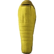
Western Mountaineering

Material: 210D ripstop nylon, 420D nylon, 600D polyester Volume: 3966 cu in Waist Belt: yes Access: front panel Gear Loops: yes Ice Axe Carry: yes Trekking Pole Carry: yes Rain Cover: yes Compression: yes Dimensions: 31.5 x 13.8 x 13 in Claimed Weight: 4 lbs 5.14 oz, 4 lbs 6.9 oz Recommended Use: backpacking, hiking & camping Manufacturer Warranty: limited

One of the issues related to Pico de Orizaba (the highest volcano of North America) is the numbers of its published heights. Any data from 18400 feet to 18900 feet are claimed as a true. With the increasing of GPS reliability the numbers informal and at least one scientific surveys have been taken to determine the true height of the volcano. According to Stephen Brown, a professor at the University of Texas (USA, San Antonio) the real height of Orizaba is 18490,5 feet with maximum error of 50 feet.
Read more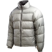
Western Mountaineering

Download printable version here Well, guess what: is it Mont Blanc? Kilimanjaro? Is it Aconcagua? Take a moment to rea...
|
Connect via: or
|
|
MOUNTAIN PLANET CONNECTS ADVENTURE GUIDES WITH OUTDOOR ENTHUSIASTS
Help us to make the mountains safer and more accessible to people by contributing secure information about routes, conditions, equipment and service providers
WHAT IS MOUNTAIN PLANET?
WHY SHOULD I REGISTER/SIGN UP?
|
We use cookies to enhance your visit to our site.