Herschel Supply Settlement Backpack - Youth - 610cu in
Herschel Supply

National Geographic Maps: Trails Illustrated California Pacific West Maps

Scale: 1 : 80000 Folded Dimensions: 4.25 x 9.25 Waterproof: yes Recommended Use: Hiking, backpacking in Sequoia and Kings Canyon National Park area

First sent by Ron Kauk who worked it for over two months in 1978 with fellow hardman John Bachar, this line up the Columbia Boulder stands as a true milestone in modern rock climbing. The first female ascent of Midnight Lightning was by Lynn Hill, though she used a toprope to suss the moves, but this was before the days of crashpads as we know them today. Little Lynnie started trying it in 1995 and completed it in 1998. The problem had been easily identified by a chalk lightning bolt draw by John Bachar in 1978 while attempting the problem with John Yablonski and Ron Kauk. In May 2013, the iconic chalk lightning bolt was scrubbed off the face of the boulder. The bolt was re-drawn in the same location a few days later.
Read more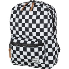
Herschel Supply


If you hear that climbing Kilimanjaro is a piece of cake, don’t believe it. I climbed it at least 15 times (and it is only un...
|
Connect via: or
|
|
MOUNTAIN PLANET CONNECTS ADVENTURE GUIDES WITH OUTDOOR ENTHUSIASTS
Help us to make the mountains safer and more accessible to people by contributing secure information about routes, conditions, equipment and service providers
WHAT IS MOUNTAIN PLANET?
WHY SHOULD I REGISTER/SIGN UP?
|
We use cookies to enhance your visit to our site.