Mountain Hardwear Nitrous Hooded Down Jacket - Men's
Mountain Hardwear

Length: 157 cm, 164 cm, 171 cm, 178 cm Dimensions: 116 / 85 / 104 mm, 116 / 84 / 104 mm, 116 / 83 / 104 mm, 116 / 82 / 104 mm Turn Radius: 17.1 m, 17.8 m, 18.5 m, 20.4 m Profile: early-rise tip, camber underfoot Construction: Piuma cap (torsion box) Core: Aero-Core (Aramid honeycomb compound) Edge: steel Base: sintered Tail: swallow tail Binding Included: no Claimed Weight: 4 lb 5.1 oz, 4 lb 6.8 oz, 4 lb 8.7 oz, 4 lb 12.5 oz Recommended Use: ski mountaineering Manufacturer Warranty: 3 years

Cotopaxi volcano is considered one of the highest active volcanoes in the world but what is interesting - its position in this ranking "floats" from year to year. Not far away this volcano was located on the second spot of the rating but recently a little "give up" its position, although remain its place in the TOP-5. This is due to the fact that the height of the active volcanoes may varies significantly after each eruption.
Read more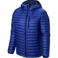
Mountain Hardwear


If you hear that climbing Kilimanjaro is a piece of cake, don’t believe it. I climbed it at least 15 times (and it is only un...
|
Connect via: or
|
|
MOUNTAIN PLANET CONNECTS ADVENTURE GUIDES WITH OUTDOOR ENTHUSIASTS
Help us to make the mountains safer and more accessible to people by contributing secure information about routes, conditions, equipment and service providers
WHAT IS MOUNTAIN PLANET?
WHY SHOULD I REGISTER/SIGN UP?
|
We use cookies to enhance your visit to our site.