
Trekking News
6 years, Australia
The Most Beautiful Day Hikes In America
Spring is here and if you haven’t dusted off your hiking shoes you better have a good excuse-like a broken leg or recent ACL surgery. The whole season is spread out before you for walking out into the showy extravagance of nature, and here are the best places in America to do that in one day.
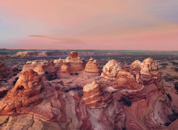 Photo credit: Ianqui Doodle/Flickr
Note: These are not ranked.
Observation Point, Zion National Park, Utah
Of course you’ve heard of Angels Landing in Zion, and The Narrows, and maybe The Subway. This one is a little longer than Angels Landing (8 miles RT), a little more strenuous, and gives a view of Zion Canyon from above-you’re actually looking down on Angels Landing, if you can wrap your head around that.
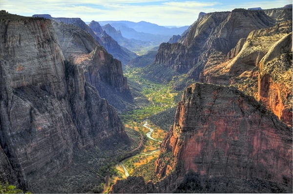 Photo: Steve Dunleavy/Flickr
Muir Snowfield, Mount Rainier National Park, Washington
Nothing in the U.S. quite compares to the massive seracs, avalanches, and rockfall on Mount Rainier-but you don’t have to climb the whole thing to get a taste. Mid-summer, you can hike up the Muir Snowfield from Paradise and watch the mountain come alive on your way up to Camp Muir with just a pair of waterproof boots and a pair of trekking poles.
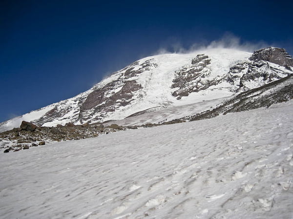 Photo: Matt Kowalczyk/Flickr
Upper Yosemite Falls, Yosemite National Park, California
We all know that the only true way to experience the magic of Yosemite is to hike up the Half Dome cables route, right? Okay, that’s not true. Also, it’s a little tough to get a permit these days. For a much-less-crowded but just as amazing day, the hike to Upper Yosemite Falls will crush your quads on your way up to a panoramic view of the Valley.
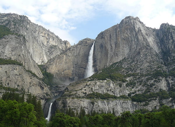 Photo: Joyce Cory/Flickr
Kalaulau Trail, Kauai, Hawaii
When people say “Hawaii” and “hiking” in the same sentence, they usually also say “Na Pali Coast,” and for good reason. Walking the 11-mile Kalaulau Trail is the only way to see this section of rugged island coastline. It’s an out-and-back 22-mile backpacking trip with a permit, or, as of 2012 you can dayhike the first six miles to the lush, hanging Hanakoa Valley without a permit.
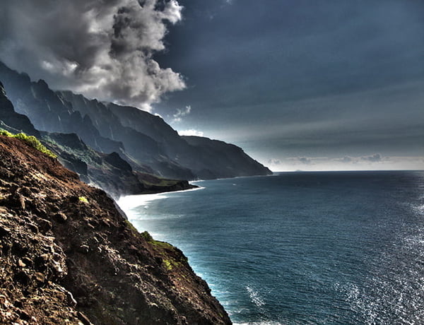 Photo: David Marks/Flickr
Antelope Canyon, Page, Arizona
The tough news is that you can’t see Upper Antelope Canyon without a paid guide for at least $30 per person, and then you’re only in the canyon for about an hour, and you only walk about a half mile. The good news is you’ve seen a billion photos of the trippy, wavy sandstone walls in the canyon, and they never look the same twice, depending on what time of day and what time of year you’re there. The even better news is that this is one of the only places on earth that looks better through your point-and-shoot camera than it does when you’re standing in it, even if you’re the most amateur of photographers.
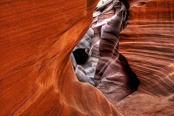 Photo: James Gordon/Flickr
Coyote Buttes North, aka “The Wave,” Paria Canyon/Vermillion Cliffs Wilderness, Arizona
The tough news, like Antelope Canyon, is that Coyote Buttes North is only accessible with a permit, secured through a lottery, or getting extremely lucky and finding someone else has canceled. The good news is, just like Antelope Canyon, you’ve seen photos of The Wave all over the place-the perfectly parallel striations on the slopes of sandstone buttes look like Dr. Seuss drew them on.
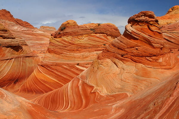 Photo: Frank Kovalchek/Flickr
Rim-to-Rim, Grand Canyon National Park, Arizona
Sure, packing the entire Grand Canyon from North Rim to South Rim in one day means you’ll miss some things-but we’re talking day hikes here, and if you want the most Grand Canyon for your day’s work, tackle this 23.5-miler in 24 hours. From the tall forests on the North Rim down to the Colorado River and back up, you’ll walk backwards in time through millions of years of geology and back again, with a cup of coffee (or beer) at Phantom Ranch midday.
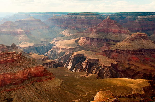 Photo: Frank Kovalchek/Flickr
Tallulah Falls North and South Rim Loop, Tallulah Gorge State Park, Georgia
Tallulah Gorge is 1,000 feet deep and two miles long, making it one of the most dramatic canyons in the East. The North and South Rim Loop might be the best way to pack it all in-climbing up from the bottom, passing four waterfalls, including the tallest in the canyon, 96-foot-tall Hurricane Falls.
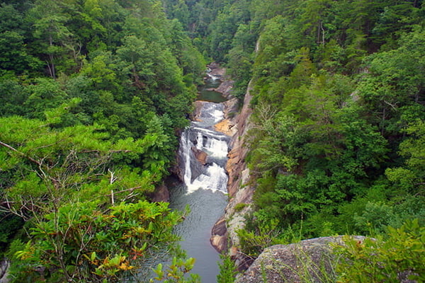 Photo: Ted Van Pelt/Flickr
Ptarmigan Tunnel, Glacier National Park, Montana
If you’ve been to Glacier National Park, you know how tough it is to recommend one thing to do there-it’s like choosing which one of your kids is your favorite. The Ptarmigan Tunnel hike wins on simple math: one big hike, commanding views of two glacial valleys from above, and one of those views coming as you pop out of the 240-foot long historic Ptarmigan Tunnel.
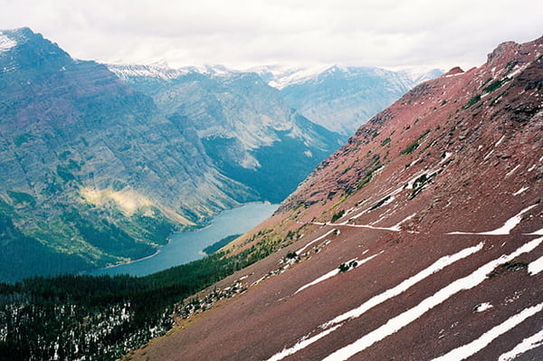 Photo: Brian and Jaclyn Drum/Flickr
Star Dune, Great Sand Dunes National Park, Colorado
America’s tallest sand dune is in Colorado, with a backdrop of 14,000-foot peaks rising behind it. In the otherworldly Great Sand Dunes National Park, the hike to the top of Star Dune takes about five hours round-trip-you’re hiking up and down sand, remember, and we said “most beautiful,” not “quickest.”
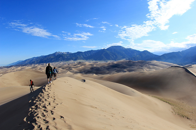 Photo: David Fulmer/Flickr
Tall Trees Trail, Redwoods National Park, California
The tallest living tree in the world is somewhere in Redwoods National Park, but you’ll never know where it is-its location is top-secret. The Tall Trees Grove is home to a tree 16 feet shorter than the world record: the 363-foot tall Libbey Tree. And seriously, craning your neck and staring straight up at it, you won’t be able to tell the difference. Or know if it’s taller than the other ginormous redwoods that are its neighbors on the Tall Trees Trail, a 3.7-mile permit-only hike.
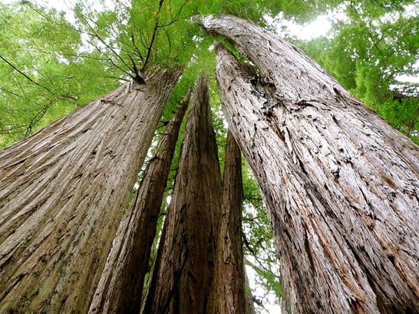 Photo: Monty VanderBilt/Flickr
Precipice Trail, Acadia National Park, Maine
Acadia’s claim to fame is its cliffy coastline and rocky summits in view of the Atlantic Ocean-they come together on this 102-year-old route drilled into the granite on Champlain Mountain, climbing up 1,000 feet to the summit, often using the iron rungs installed in 1912 by Rudolph Brunnow.
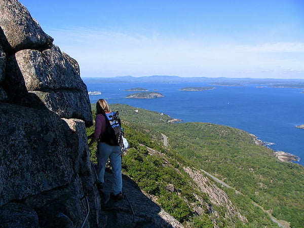 Photo: Wayne Boardman
Harding Icefield, Kenai Fjords National Park, Alaska
You don’t have to get dropped off by a bush pilot to see the largest icefield in North America. The trail to a viewpoint of the 300-square-mile Harding Icefield starts at a parking lot at Kenai Fjords National Park, and climbs 3,400 feet in 4.1 miles through bear habitat to a view of the stark ice sheet with peaks popping out of it.
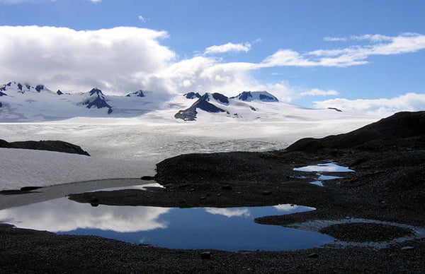 Photo: Ianqui Doodle/Flickr
Knife Edge, Katahdin, Baxter State Park, Maine
What an exposed ending Appalachian Trail thru-hikers have to their journey: Katahdin’s three-foot-wide “Knife’s Edge” drops a thousand-plus feet off either side for 1,500 feet of trail. Remember to breath, and to enjoy the 360 views of the surrounding mountains, while you’re up there checking off this East Coast bucket list item.
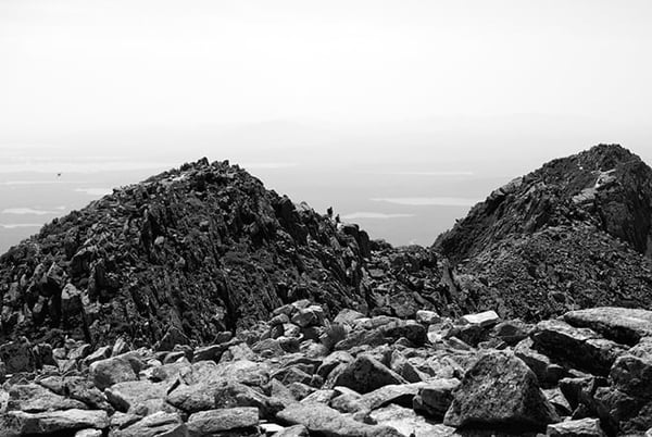 Photo: Ellsworth Bell
Mt. Scott, Crater Lake National Park, Oregon
Oregon’s Crater Lake is the deepest lake in America, and the seventh deepest in the world, at almost 2,000 feet deep. It’s blue. Really blue. The highest non-airplane view you can get looking down into its depths is on top of 8,832-foot Mount Scott, a stout 2.5 miles gaining 1,100 feet to the summit, perched on the rim of the crater.
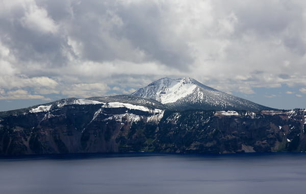 Photo: Matt Malone
Rocky Top from Cades Cove, Great Smoky Mountains National Park, Tennessee
Good old Rocky Top, Tennessee, is mentioned every time the University of Tennessee’s band fires up the fight song, and it’s not for no reason. The summit, popping with rhododendrons and plenty of green, is one of the best places to take in the views of the Smokies. Heading up from Cades Cove makes it a worthy 13-mile round-trip hike.
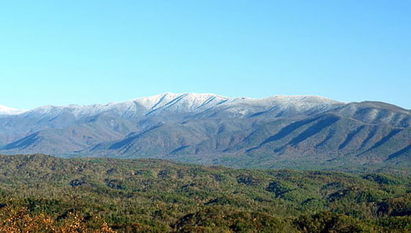 Photo: Notneb82/Wikimedia Commons
Gothics via Lower and Upper Wolfjaw mountains, Adirondacks, New York
Here’s a good way to start an argument: Say that either Whiteface, Mt. Marcy, or Gothics is the most beautiful peak in the Adirondacks. Here’s why we pick this one: the drama. All three are great summits and have great views, but Gothics has incredible rock slabs surrounding the summit, and cables to aid hikers. Whiteface has a road and an elevator, and Marcy has the crowds that come along with being the highest peak in the state. This route tackles three Adirondack 46er summits on the way to the top: Lower and Upper Wolfjaw, and Armstrong Mountain, all higher than 4,000 feet.
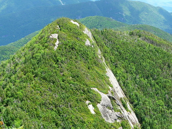 Photo: Notneb82/Wikimedia Commons
Hoh River Trail, Olympic National Park, Washington
One of the last remaining examples of a temperate rainforest that once stretched all the way from California to Alaska, the Hoh River trail walks under a dense canopy that owes its green to the 12-plus feet of precipitation that falls there annually. Bring a rain jacket and walk as far back as you want-the trail is mostly flat all the way back to the Olympus Ranger Station, 10.3 miles down the trail.
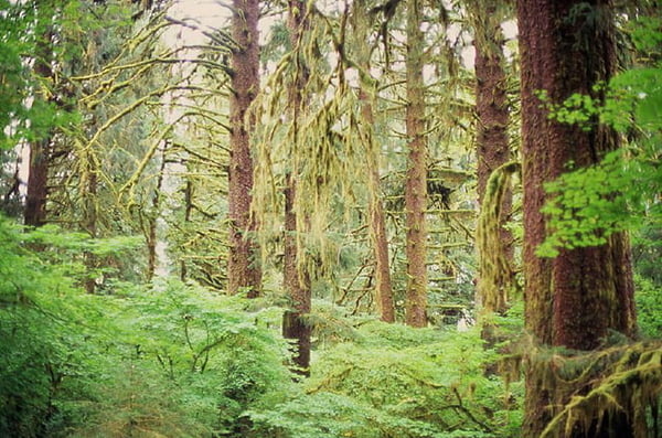 Photo: Daniel Pellegrino/Flickr
Old Rag Mountain via the Ridge Trail, Shenandoah National Park, Virginia
It’s four miles through the forest, up onto scrambly granite boulders on the ridgeline, to the top of Old Rag Mountain and wraparound views of 300-plus square miles of protected wild land below-you won’t be alone on this one, but it’s worth sharing, especially in the fall.
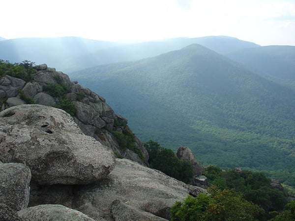 Photo: Chappie/Flickr
Franconia Ridge, White Mountains, New Hampshire
Think of it as a one-day-sized Presidential Traverse where you’ll have time to get a beer and a burger afterwards: This nine-mile ridge traverse tags the 5,000-foot summits of Lafayette and Lincoln, walking across the skyline for 1.7 miles between with huge views to both sides.
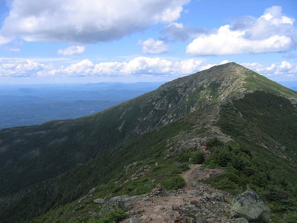 Photo: Scott Sayre/Flickr
by BRENDAN LEONARD
This article first appeared on http://www.adventure-journal.com. The original can be read here.


