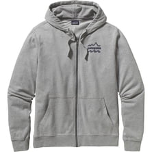
Patagonia Brushed Badge Full-Zip Hoodie - Men's
Patagonia

Dimensions: 2.4 x 6.3 x 1.4 in Display Dimensions: 1.43 x 2.15 x 2.6 in Antenna: quad helix Routes: 200 Waypoints: 5000 Mapping: yes, Geocaching Digital Compass: no Display Resolution: 160 x 240 pixels Computer Compatible: yes, USB Waterproof: yes, IPX-7 standard (submerged 1 meter for 30 mintues) Battery Type: 2 AA, optional NiMH pack Card Type: microSD Included Software: BaseCamp Claimed Weight: 8.1 oz Recommended Use: travel, hiking & camping Manufacturer Warranty: 1 year

Perviously it was considered, that the highest peak of the world lies in Karakorum mountain range. American expedition "K-2" March 6, 1987 reported that the height of the hill is in the range of 8858 to 8908 m, thus it is the highest in the world. However, August 13, 1987, these measurements have been refuted by Chinese surveyors, defined by the height of Mount Everest as 8848 m and K2 - 8611 m.
Read more
Tallest does not always mean toughest. There are plenty of mountains lower than Mount Everest and much more deadly. Some o...
|
Connect via: or
|
|
MOUNTAIN PLANET CONNECTS ADVENTURE GUIDES WITH OUTDOOR ENTHUSIASTS
Help us to make the mountains safer and more accessible to people by contributing secure information about routes, conditions, equipment and service providers
WHAT IS MOUNTAIN PLANET?
WHY SHOULD I REGISTER/SIGN UP?
|
We use cookies to enhance your visit to our site.