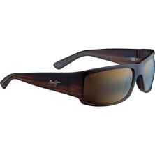
Maui Jim World Cup Sunglasses - Polarized
Maui Jim

Material: 100% woven straw Style: fedora Recommended Use: beachwear

The Mount Manaslu area was closed for a public for a long time due to the proximity of Tibet border. Just a few big expeditions were allowed to climb Mount Manaslu. In 1992 the Manaslu Circuit trek was opened for public but still climbing this route should be accompanied with a licensed Nepalese guide.
Read more
Download printable version here Well, guess what: is it Mont Blanc? Kilimanjaro? Is it Aconcagua? Take a moment to rea...
|
Connect via: or
|
|
MOUNTAIN PLANET CONNECTS ADVENTURE GUIDES WITH OUTDOOR ENTHUSIASTS
Help us to make the mountains safer and more accessible to people by contributing secure information about routes, conditions, equipment and service providers
WHAT IS MOUNTAIN PLANET?
WHY SHOULD I REGISTER/SIGN UP?
|
We use cookies to enhance your visit to our site.