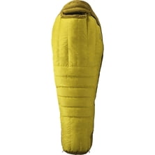
Voile Switchback Telemark Ski Binding
Voile

National Geographic Maps: Trails Illustrated West Virgina Map

Scale: 1 : 55,000 Folded Dimensions: 4.25 x 9 in Waterproof: yes Recommended Use: interpreting your landscape Manufacturer Warranty: limited

Siemen are recognizable with their unique landscape have, but they have a twin brother in South Africa - a similar geological structure of the Drakensberg Mountains in the south of the continent, and Siemen mountains make them very similar in appearance. Because of the altitude, Siemen mountains - one of the few places in Africa where it snows regularly.
Read more
Mountains care very little whether mountain guide certified or not. Do clients and mountain guides themselves need to care ab...
|
Connect via: or
|
|
MOUNTAIN PLANET CONNECTS ADVENTURE GUIDES WITH OUTDOOR ENTHUSIASTS
Help us to make the mountains safer and more accessible to people by contributing secure information about routes, conditions, equipment and service providers
WHAT IS MOUNTAIN PLANET?
WHY SHOULD I REGISTER/SIGN UP?
|
We use cookies to enhance your visit to our site.